Day 1 · FridayWith Zain
Day 1 · Fri 30 OctUp the Baunei coast: Pedra Longa, Golgo and Cala Goloritzé
Land, collect two cars, and drive straight up the east coast to the most famous hike in Sardinia. Goloritzé is booked online and the trail closes in the early afternoon, so the morning is about reaching the Golgo plateau by noon. The mountain road to Cala Gonone is done in the dark at the end of the day.
Before you set off
- Book Cala Goloritzé on Tue 27 Oct at 00:00. Dates open 3 days ahead on heartofsardinia.com or the “Heart of Sardinia” app. €7 per person, paid online, non-refundable, QR code. 250 people at a time. In 2026 booking is mandatory from 24 March to 15 November, so it applies on 30 Oct. If the booking page offers the afternoon access (enter the trail between 12:00 and 13:30), take it: it fits a noon arrival.
- Closed shoes with grip for both of you: the rangers check them at the gate.
- 2 litres of water each, plus picnic lunch. There is no water, bar or toilet on the trail or at the beach.
- Swimsuit and a small towel. The sea is about 20 °C.
- Head torch in the car: you drive the mountain road to Cala Gonone after dark.
- Download offline Google Maps for the whole Ogliastra and Dorgali area. Signal is patchy in the canyon and on the SS125.
- Agree with Zain to drive in convoy, and share live locations. If you lose each other, meet at the Su Porteddu car park.
- Fuel at Baunei. There is no petrol station on the SS125 between Baunei and Dorgali.
Step by step
- 07:201Arrive
Land at Cagliari Elmas and pick up both cars
Hand luggage only, so you can be at the rental desks in the arrivals hall within 15 minutes. Aim to drive off at about 08:00. Zain takes his own car, because he drives home from the Gorropu trailhead tomorrow.
Target: driving by 08:00 - 08:00Drive
Airport → Conad Superstore, Quartu
15 km · 25 minSS554- Leave the airport following the signs for Cagliari / SS554 / Quartu – Villasimius – Tortolì.
- The SS554 is Cagliari’s eastern ring road: four lanes, but with junctions and traffic lights. Keep to the posted limit.
- Near its eastern end, turn off for Quartu Sant’Elena. The Conad is on Viale Marconi, about 2–3 km off the SS554. Let Google Maps take you the last bit.
Conad Superstore car parkA large outdoor car park in front of the store. The store is open every day 08:00–21:00 (Conad’s own page). Tel +39 070 828 1520.
Cost: Free
Navigate here ↗Pin39.24848, 9.19498
- 08:252Shop
Picnic shopping, 20 minutes
Buy today’s lunch, snacks, 4–5 litres of water and breakfast for tomorrow. You can shop again in Dorgali or Cala Gonone on Saturday. Sunday is a public holiday.
Backup next door: EuroSpin (Mon–Sat 08:30–20:30). Or MD Quartucciu on Via Mandas, on the way back to the SS554 (daily 08:00–21:00; hours from OpenStreetMap, not confirmed).
- 08:50Drive
Quartu → Pedra Longa
132 km · 2 h 15SS554SS125 (new)SS125varSS125- Rejoin the SS554 eastbound. It runs straight on into the new SS125, a fast dual carriageway past Maracalagonis and San Priamo. Follow Tortolì / Muravera.
- It continues as the SS125var past Muravera and Villaputzu. Around Tertenia there are short stretches on the old SS125, where the signs for Tortolì keep you on track.
- At Tortolì keep following the SS125 north, signed Lotzorai / Baunei / Nuoro. Ignore the turn for Arbatax unless you’re doing Rocce Rosse (see the note below).
- After Lotzorai and Santa Maria Navarrese the road starts to climb towards Baunei. About 1.2 km before the Baunei petrol station, turn right at the “Pedra Longa” sign (40.01837, 9.67821).
- A narrow, steep paved road drops 3.7 km to the sea. Go slowly on the blind bends.
Optional: Rocce Rosse at Arbatax
Only if you’re past Muravera by about 09:45. In Tortolì follow “Arbatax / Porto”. The red porphyry rocks (39.93920, 9.71019) are a few minutes’ walk east of the port, opposite the Trenino Verde station. Park at the port-side car park (39.94046, 9.70730). It adds 30–40 min. Without it you reach the Goloritzé trailhead at about noon; with it, nearer 12:40.
Pedra Longa, end of the roadA small free car park by the Pedralonga restaurant, with roadside spaces just before it (40.02747, 9.70458). It may be closed for the season.
Cost: Free
Navigate here ↗Pin40.02691, 9.70553
- 11:053Stop
Pedra Longa
A 128 m limestone needle standing in the sea. Walk the 150 m from the car park to its foot along the rocks. This is also where the Selvaggio Blu, Sardinia’s hardest coastal trek, starts. Stay 15–20 minutes, then move on: the trailhead is the priority.
15–20 min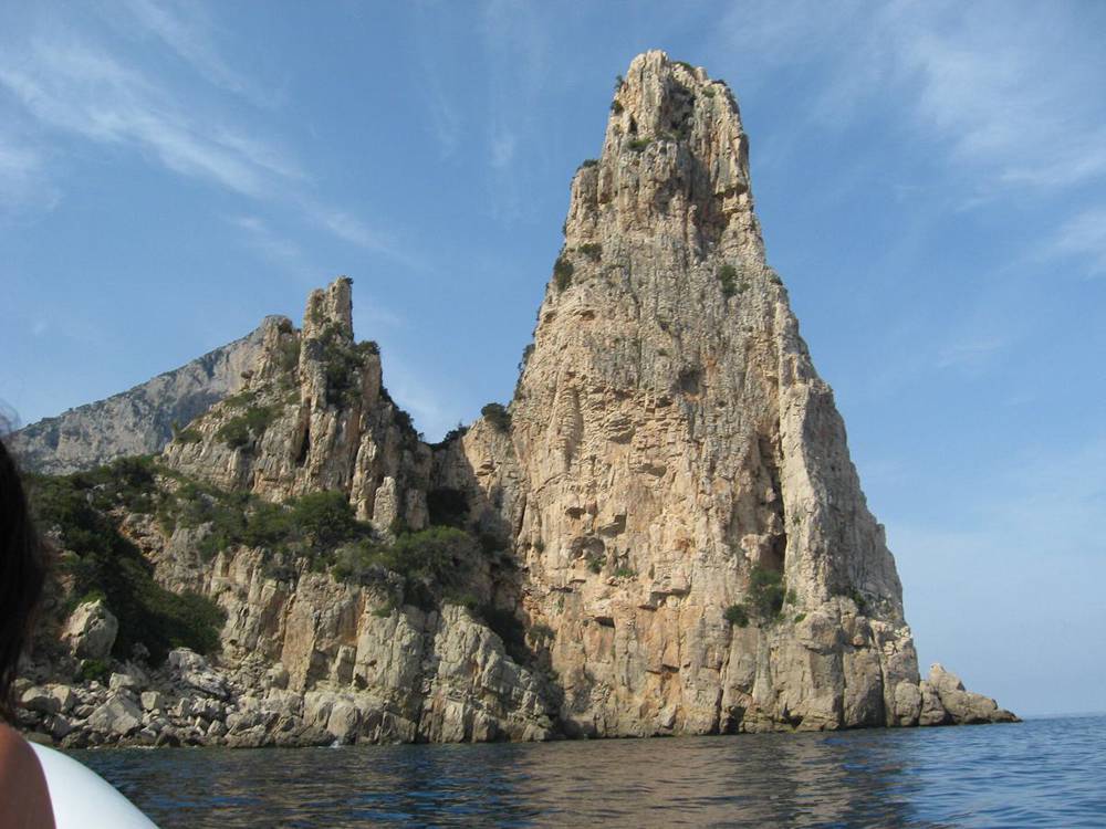
fotografia di Rosanna C. · CC BY 2.5 - 11:25Drive
Pedra Longa → Golgo plateau, Su Porteddu
15 km · 40 minSS125Via San Pietro- Drive back up to the SS125 and turn right towards Baunei.
- Fill up at the Api-IP at the south entrance of Baunei (40.02624, 9.66857). It’s the last fuel before Dorgali.
- In the village, turn right into Via Dante Alighieri (40.03234, 9.66261), then sharp right into Via San Pietro, just after the San Nicola church. Signs say Golgo / San Pietro / Goloritzé.
- The first 2 km are very steep, with tight hairpins between houses: first gear and patience. Then about 8 km of hairpins climb onto the plateau.
- On the plateau, expect goats, pigs and cows on the road.
- At the end of the tarmac, near Ristorante Golgo (40.08019, 9.66614), follow Su Porteddu / Goloritzé / Voragine onto a dirt track for about 1–1.5 km. It’s fine in a small car if you go slowly.
Su Porteddu car park (Goloritzé trailhead)An unpaved car park next to the Su Porteddu bar and the warden’s kiosk. Show the QR code at the kiosk. Older guides say the €7 ticket covers parking; the official page doesn’t say.
Cost: Probably in the €7 ticket
Navigate here ↗Pin40.08314, 9.67831
- 12:054Hike
Hike to Cala Goloritzé
An old mule track drops down the Bacu Goloritzé gorge to a pebble beach, with the 143 m Aguglia spire and a natural arch at the southern end. One of the most famous views in the Mediterranean, and in late October you’ll share it with only a handful of people.
The trail, step by step
Distance3.5 km each wayHeight≈ 500 m down, then upTime1 h 15 down · 2 h upGradeCAI E (hiking)WaterNone, carry 2 L each- 12:10At the warden’s kiosk, the QR code is checked. Go through the gate on the right. The path is clear and well walked.
- 12:25A gentle climb through scrub to a coastal viewpoint (≈ 0.95 km, 455 m), the high point. From here it’s downhill.
- 12:40Open heath, then a shelter cave on the right and a valley floor of old holm oaks. At ≈ 1.4 km (355 m) you pass caves used as shelters by shepherds: the old cuile (sheepfold).
- 13:00Walk under the cliffs and under a rock arch. Ignore the steep path climbing off to the left.
- 13:15The Aguglia comes into view. At the signpost near the bottom, left goes straight to the beach and right takes a slightly longer arc with the view of the spire and bay from above. Take the right on the way down and the left on the way up.
- 13:25Steps with wooden handrails lead past a picnic spot under a rock shelter onto the beach.
- 13:25–14:45Picnic, swim, photos. Don’t sit under the cliffs (rockfall). Boats must stay 300 m offshore, so the beach is quiet.
- 14:45Leave the beach, at the latest. It’s uphill almost all the way. The steepest part is the last 2 km, about 450 m of climbing.
- 16:45Back at Su Porteddu. Coffee at the bar if it’s open.
Trail hours: in by 13:00, off the beach by 16:00
The live booking page (checked 26 Oct) says the trail opens at 07:30 and closes to new walkers at 13:00 (the afternoon ticket allows entry 12:00–13:30), and you may stay on the beach until 16:00. Arriving at noon works, but there is no slack: Pedra Longa is the first thing to drop. When you show your ticket, ask the warden what time you must be off the beach and follow that.
7 km return+/− 500 m3 h 15 walkingBooked ticket required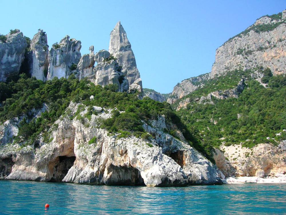
Mentnafunangann · CC BY-SA 3.0 - 16:505Stop
Su Sterru and the Piscinas, at sunset
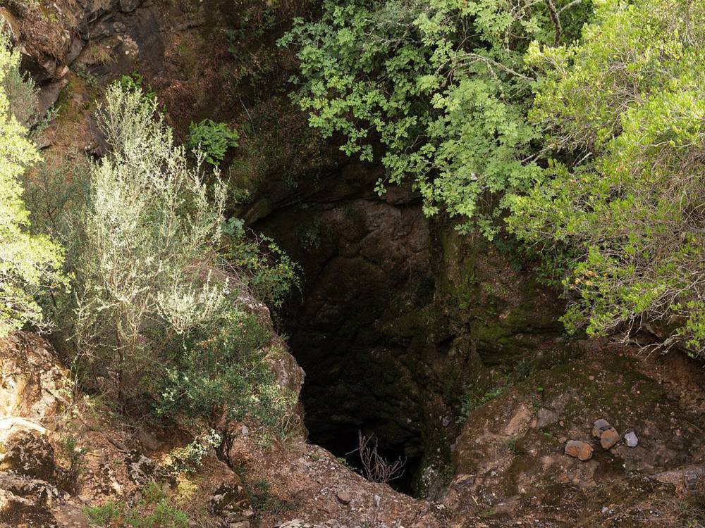
Five minutes from the car park (drive 800 m back towards the tarmac, or walk). Su Sterru (40.08294, 9.67363) is a near-perfect shaft 270 m deep in the limestone. Look from the rim and stay well back from the edge. 200 m away are the Piscinas (40.08146, 9.67367), basalt pools that hold water all year. Sunset on the plateau is at 17:21.
If you have 10 more minutes, the little church of San Pietro di Golgo (40.09075, 9.66787) is just up the plateau road.
Su Sterru car parkFree, room for about 10 cars, with a picnic area next to it.
Cost: Free
Navigate here ↗Pin40.08081, 9.67356
Unukorno · CC BY 4.0 - 17:15Drive
Golgo → Cala Gonone
62 km · 1 h 35 (dark)Via San PietroSS125SP26- Back down the Via San Pietro hairpins to Baunei, slowly, with animals on the road.
- Turn right (north) onto the SS125 Orientale Sarda, signed Nuoro / Dorgali. It’s 27 km to the Genna Silana pass (1,017 m), with endless bends but good tarmac and almost no traffic. There is no fuel on this stretch. Cloud or fog on the pass is common in autumn: dipped headlights and 40–50 km/h.
- From the pass it’s about 18 km down towards Dorgali. You’ll drive this road again in daylight tomorrow morning.
- At the T-junction south of Dorgali (40.27562, 9.59225), turn right onto the SP26, signed Cala Gonone. It goes through the Monte Bardia tunnel to a roundabout, then down the hairpins into Cala Gonone.
Night driving
Goats, sheep, cattle, horses and wild boar step out without warning on the SS125. Keep it slow on blind bends and use high beam when the road is clear. If you’re running late, it’s better to arrive at 19:30 than to rush.
- 18:506Arrive
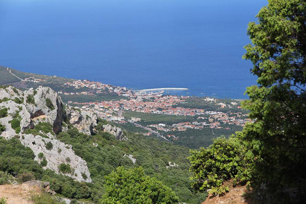
Cala Gonone: check in
Unpack, shower, dinner. Most of Cala Gonone is closed for the winter, so phone first. Pizzeria Zio Pedrillo (Via Vasco da Gama 2, +39 0784 93761, Wed–Mon from 18:30; OpenStreetMap hours, season not confirmed). Or cook: the Despar on Viale Bue Marino is open 07:00–20:30.
Gianni Careddu · CC BY-SA 4.0


If things change
Running late
- Not past Muravera by 10:00? Skip Pedra Longa and drive straight to Su Porteddu.
- Not at Su Porteddu by 12:45? The trail closes to new walkers at 13:00 (13:30 on the afternoon ticket). If you miss it, walk to the 0.95 km viewpoint and back (40 min), then spend the afternoon at Su Sterru, the Piscinas and San Pietro.
- Back up later than 17:15? Don’t stop at Su Sterru; go straight down while there’s still some light.
Easier version (you’ve been up since 03:30)
Skip the Goloritzé hike. Do the Golgo plateau (Su Sterru, the Piscinas, San Pietro), then cross Genna Silana in daylight at about 15:00 and be in Cala Gonone by 16:30 for a nap. Move Goloritzé to Sunday in place of Cala Luna: from Cala Gonone it’s 1 h 15 to Su Porteddu. That needs a new booking (Sunday dates open at 00:00 on Thu 29 Oct).
If it rains
Take the inland route via the SS131 and Nuoro instead (2 h 30): the Museo del Costume or the MAN in Nuoro, then the Grotta di Ispinigoli near Dorgali. The Goloritzé trail is dangerous when wet (polished limestone).
Numbers and links
Goloritzé
- Heart of Sardinia bookingWeb or app. Opens 00:00 on 27 Oct for 30 Oct.
- Phone / WhatsAppOffice +39 349 546 2583 (weekday mornings) · Infopoint +39 380 461 6989
- Baunei tourism officeinfopoint@turismobaunei.eu
On the road
- Conad Superstore QuartuDaily 08:00–21:00 · +39 070 828 1520
- Api-IP BauneiSS125, south entrance of the village · last fuel before Dorgali
- Fuel in Cala GononePuddu Carburanti, 24 h self-service (40.28102, 9.62279)
- Emergency112