Day 7 · Thursday
Day 7 · Thu 5 NovPorto Pino, the Costa del Sud, Chia and the Sella del Diavolo
The whole south coast in one go. A long white beach, the Costa del Sud cliff road with its famous turquoise coves, a Spanish watchtower over the Chia dunes, and a sunset walk above Cagliari. Then a fast road in the dark to the last base.
Before you set off
- Check out of Nebida. This is the longest driving day: about 225 km.
- The Porto Pino white dunes will almost certainly be closed. They’re inside the Capo Teulada NATO firing range and are only opened to the public in summer (roughly June–September). If you want to be sure, ask the Comune di Teulada; otherwise plan for the beach only.
- Fuel before the Costa del Sud: there’s no station on the SP71. Use Carbonia, San Giovanni Suergiu or Teulada.
- Head torches for coming down from the Sella del Diavolo after sunset.
- Cagliari ZTLs. Don’t drive into the old quarters (Marina, Stampace, Castello, Villanova) or onto the Lungomare Poetto, which is camera-controlled 24/7. Use Viale Poetto.
- Phone Crar’e Luna in Chia (+39 070 923 0041) to check lunch.
Step by step
- 08:30Drive
Nebida → Porto Pino
48 km · 1 h 10SP83SS126SS195SP73- SP83 south about 6 km to Gonnesa, then the SS126 south past Carbonia, through a long chain of roundabouts. Follow Sant’Antioco / S. Giovanni Suergiu.
- At San Giovanni Suergiu turn left onto the SS195 towards Teulada / Porto Pino, for about 9 km.
- Turn right onto the SP73 for Porto Pino, about 10 km, past the pink-tinged lagoons, into the village (Via del Mare).
Porto Pino, Prima Spiaggia car park Check on the dayPay-and-display in summer; off-season charging isn’t confirmed. A second car park is at 38.96427, 8.59660. The car park for the dunes end (38.95731, 8.62197) is reached by a signed dirt road across the lagoon before the village; it’s only useful when the dunes are open.
Cost: Summer pay-and-display
Navigate here ↗Pin38.96354, 8.59752
- 09:401Walk
Porto Pino beach
A long white beach backed by Aleppo pines, with lagoons behind it. Walk east along the Prima Spiaggia and then the Seconda Spiaggia (about 2 km of white sand) towards the dunes, as far as the military boundary signs, and don’t cross them: there may be unexploded ordnance. Back to the car along the shore.
≈ 1 hWhite dunes: closed off-season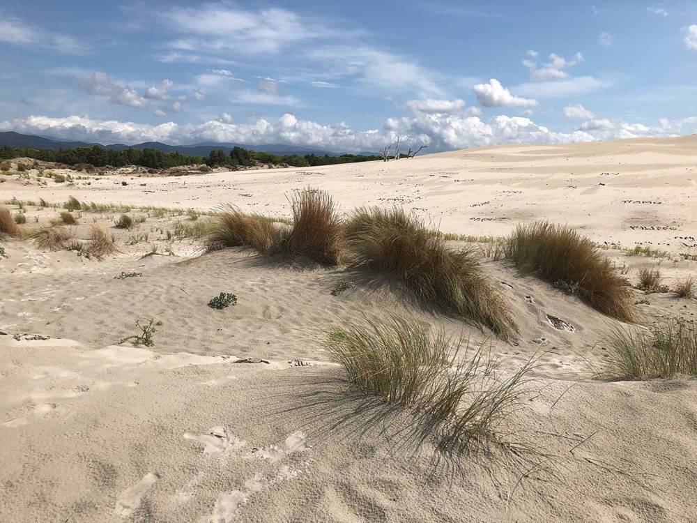
Einaz80 · CC BY-SA 4.0 - 10:40Drive
Porto Pino → Capo Malfatano
33 km · 45 minSP73SS195SP71- Back up the SP73 to the SS195 at Sant’Anna Arresi, then east about 10 km to Teulada.
- About 3 km past Teulada, turn onto the SP71, signed Porto di Teulada. This is the start of the Costa del Sud panoramic road: about 25 km of bends above the sea. There are few guardrails, cattle and goats on the road, and no fuel.
- Optional stops: the Porto Budello marina (38.92734, 8.71868) and the view down to Piscinnì beach (38.91238, 8.78155).
Capo Malfatano lay-byA free gravel lay-by on the SP71 above the Malfatano inlet, with a second one just west (38.89492, 8.79844). The Spanish tower stands on the headland opposite.
Cost: Free
Navigate here ↗Pin38.89902, 8.80230
- 11:252View
Capo Malfatano and Tuerredda viewpoints
Two of the best views on the south coast. Five minutes at Malfatano, then 2 km further east to the classic Tuerredda viewpoint on the SP71 (38.89511, 8.81819), looking down on a white sandbar and a tiny island. Pull off only where the shoulder is wide.
To go down to Tuerredda beach itself: the car park is at 38.89688, 8.81464 (€10 in summer, unpaved, off-season charging not confirmed). Allow 40 min.
2 × 10 min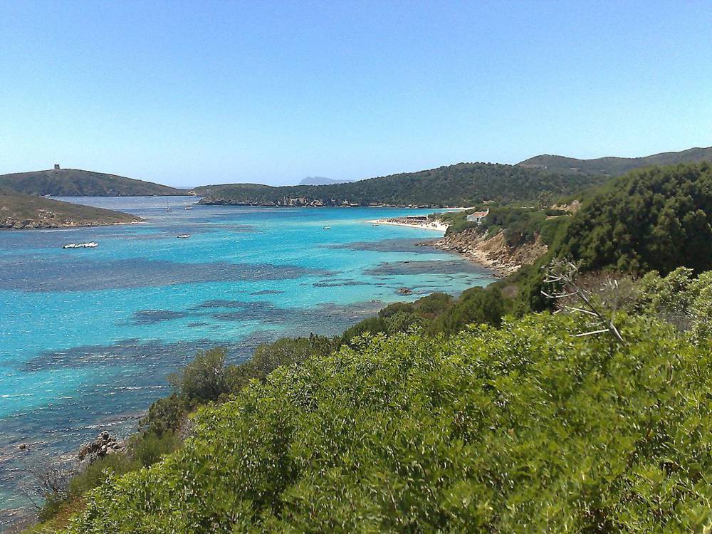
zipckr · CC BY 2.0 - 11:50Drive
Tuerredda → Chia
10 km · 15 minSP71- Carry on east along the SP71 into Chia. Follow Viale Chia, then Viale del Porto for the tower.
Torre di Chia car parkA paid car park off Viale del Porto in summer, with a second at 38.89686, 8.88098. A free dirt car park is at 38.90121, 8.88681.
Cost: Summer fee; free lot nearby
Navigate here ↗Pin38.89791, 8.88368
- 12:053Walk
Torre di Chia and Su Giudeu
A paved path climbs 300 m (10 min) to the 1578 Spanish watchtower. You can’t go inside, but from the top you see the dunes of Su Giudeu, its little islet, and the Stagno di Chia lagoon behind, where flamingos often feed. Then walk the dunes to Su Giudeu (38.88401, 8.86348), or drive to its car park, Erbexili (38.88987, 8.86526).
Lunch: Crar’e Luna on Viale Chia or Bistrò Cafè Aquadulci (November opening not confirmed for either; phone first). If both are shut, L’Incontro Market on Viale Chia (07:30–21:00) for a picnic. Pula, 20 min on, has the most year-round restaurants.
Tower 10 min upLunch 12:45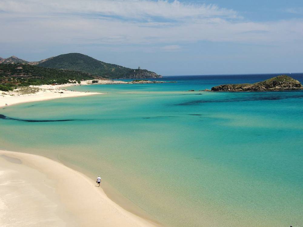
emmequadro61 · CC BY 2.0 - 14:20Drive
Chia → Cagliari, Marina Piccola
58 km · 1 h 15SS195SS195bisSS195dirViale Poetto- SP71 to the SS195, north past Pula. At the Pula roundabouts follow the SS195bis “Nuova Sulcitana” (about 19 km of dual carriageway), then the SS195dir and the SS195 into Cagliari.
- Along the port (Via Riva di Ponente, then the Via Roma seafront) and Viale Diaz. Don’t turn left up into the old town: those are ZTL camera zones.
- Viale Campioni d’Italia, then Viale Poetto (not the Lungomare) to the roundabout into Via Marina Piccola.
Marina Piccola car parkA free surface car park at the harbour at the end of Poetto beach. If you see blue lines, they’re about €0.50–1.50 an hour, Mon–Sat 08:00–20:00, paid at the meter or by app.
Cost: Free
Navigate here ↗Pin39.19372, 9.15686
- 15:354Wildlife
Optional: flamingos at Molentargius
If you’re on time: the park entrance (Edificio Sali Scelti, Via La Palma 9) is 6 min from Marina Piccola. Walk 1 km north on the Sentiero del Bellarosa Maggiore to the hide facing the dike where hundreds of flamingos winter. Free; binoculars €1.
Molentargius park entranceA free car park by the entrance (another at 39.20555, 9.14641). Winter hours (16 Oct–28 Feb) are 07:00–18:00 daily, per the park’s own site: +39 070 379191.
Cost: Free
Navigate here ↗Pin39.20524, 9.14897
≈ 40 minFree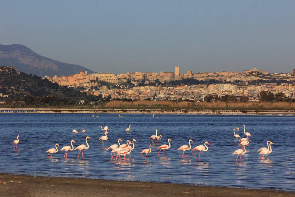
Stefano Marrocu · CC BY-SA 3.0 - 16:205Hike
Sella del Diavolo at sunset
The “Devil’s Saddle”: the headland at the end of Poetto beach, with WWII lookouts, Punic and Roman cisterns and the ruins of a temple to Astarte on top, and views over the turquoise coves and the whole Gulf of Cagliari.
The walk, step by step
Distance≈ 3.5 km returnHeight≈ +140 mTime≈ 1 h 30 with sunsetTerrainRocky pathAfter darkHead torches- 16:20From the car park walk south-east along Via Marina Piccola past the Yacht Club to the end of the harbour and the trailhead (39.1915, 9.1615), about 8 min.
- 16:30Climb the clear path (about 0.9 km) to the summit plateau. It skirts a fenced NATO fuel depot and military land: stay off any fenced track.
- 17:05On top (≈ 135 m): the Torre di Sant’Elia lookout and WWII fortino, the cisterns and the temple ruins. Walk to the belvedere (39.18877, 9.16563) for the view down onto Cala Fighera and back over Poetto and Cagliari.
- 17:18Sunset, over the city and the gulf.
- 17:30Head torches on and go back down the same path. The limestone is polished and loose on the descent, so take it slowly.
- 18:05Back at the car.
Longer daytime version (≈ 6 km, +270 m, 2–2.5 h): from the top, carry on down to the Cala Fighera viewpoint, the Batteria Prunas bunkers near Capo Sant’Elia, and Calamosca beach, then back over the saddle.
≈ 3.5 km+140 mSunset 17:18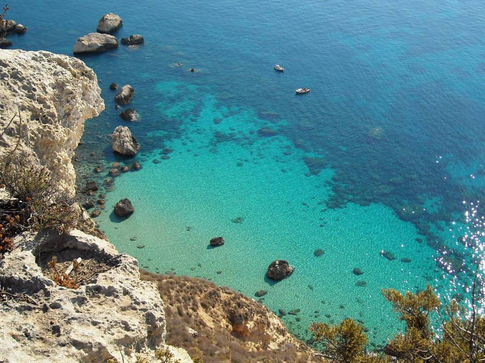
cristianocani · CC BY 2.0 - 18:10Drive
Cagliari → Villasimius
64 km · 1 h 15SS554SS125varSP19- From Poetto, follow signs to the SS554 (via Quartu). East to its end and onto the new SS125 / SS125var towards Muravera / Castiadas, about 23 km of fast road.
- Exit for Villasimius onto the SP19, about 11 km over the hills into town.
Why not the coast road
The SP17 along the coast is about 20 minutes slower, narrow, unlit and full of blind bends, and you won’t see anything in the dark. You’ll get coastal views tomorrow.
- 19:306Arrive
Villasimius: check in and dinner
Phone first. Candidates: La Lanterna, Via Roma 64 (+39 347 473 9873); Sa Tankitta, Semplice (+39 329 114 0259) or Carbonara on Via Umberto I; Doppio Malto on Via del Mare (+39 070 804 6426), a chain and the most likely to be open. Groceries: Conad City on Via Raffaello (Mon–Sat 08:00–20:30, Sun 08:30–14:00 and 16:00–20:30).


If things change
Running late
Drop Molentargius first, then cut the Sella to just the summit. If you’re still at Chia after 15:00, skip the Sella altogether: drive to Villasimius on the inland road in daylight and do the Sella on Friday morning instead (50 min from Villasimius).
Easier version
Skip Porto Pino and drive straight to the Costa del Sud (Nebida → Teulada about 1 h 15). That gives you a slow lunch in Chia and Tuerredda beach.
If it rains
Is Zuddas only opens at weekends from 2 Nov, so it’s not an option today. Go to Cagliari: the Museo Archeologico Nazionale (daily 08:30–19:30, €10; but some floors are closed for renovation and the Mont’e Prama giants have moved to Cabras, so phone +39 070 655911 first) and the Castello quarter on foot: park outside the ZTL and walk up.
Numbers and links
South coast
- Crar’e Luna, Chia+39 070 923 0041 · crareluna.it
- L’Incontro Market, Chia+39 070 649 5784
- Porto Pino dunesInside the Capo Teulada range · open in summer only
Cagliari and Villasimius
- Molentargius park+39 070 379191 · parcomolentargius.it
- Doppio Malto Villasimius+39 070 804 6426
- Fuel in VillasimiusAgip, Via Roma
- Emergency112